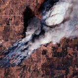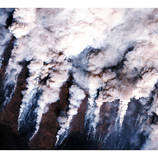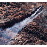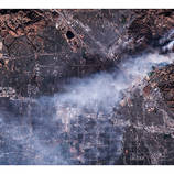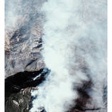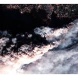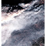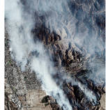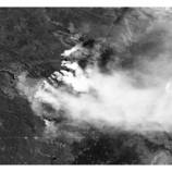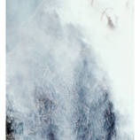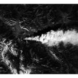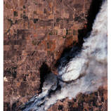


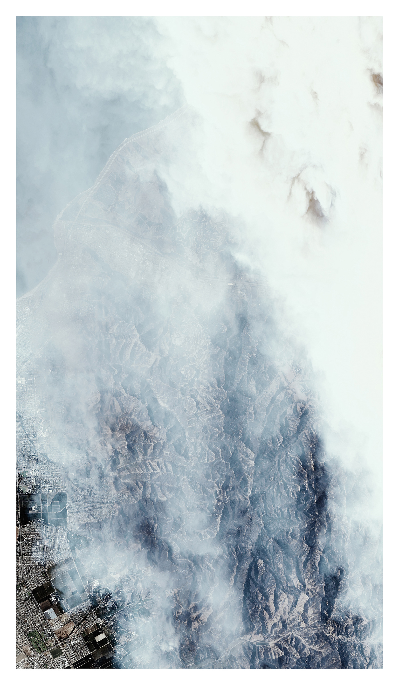
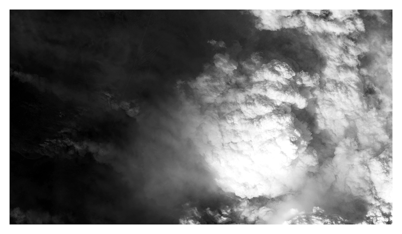
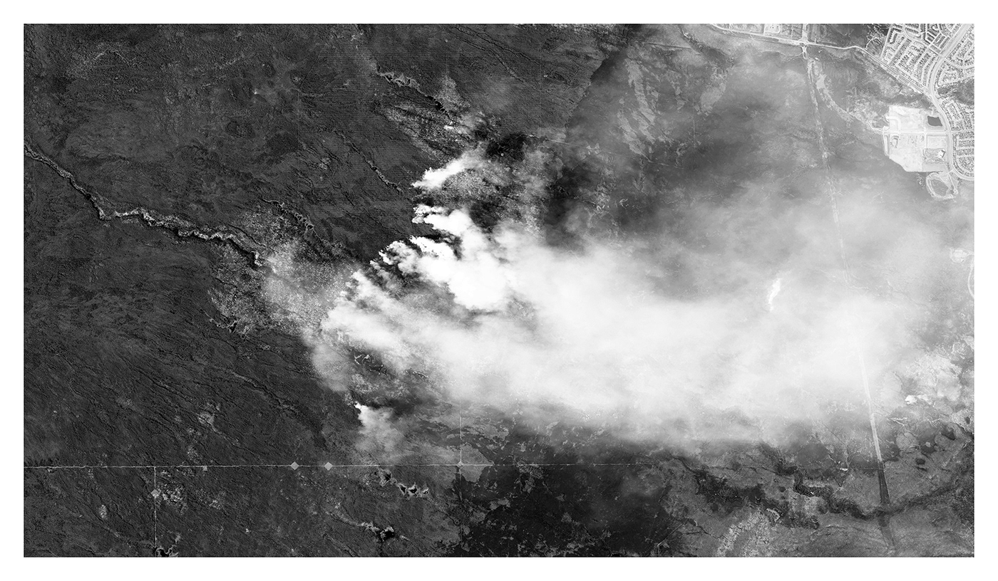
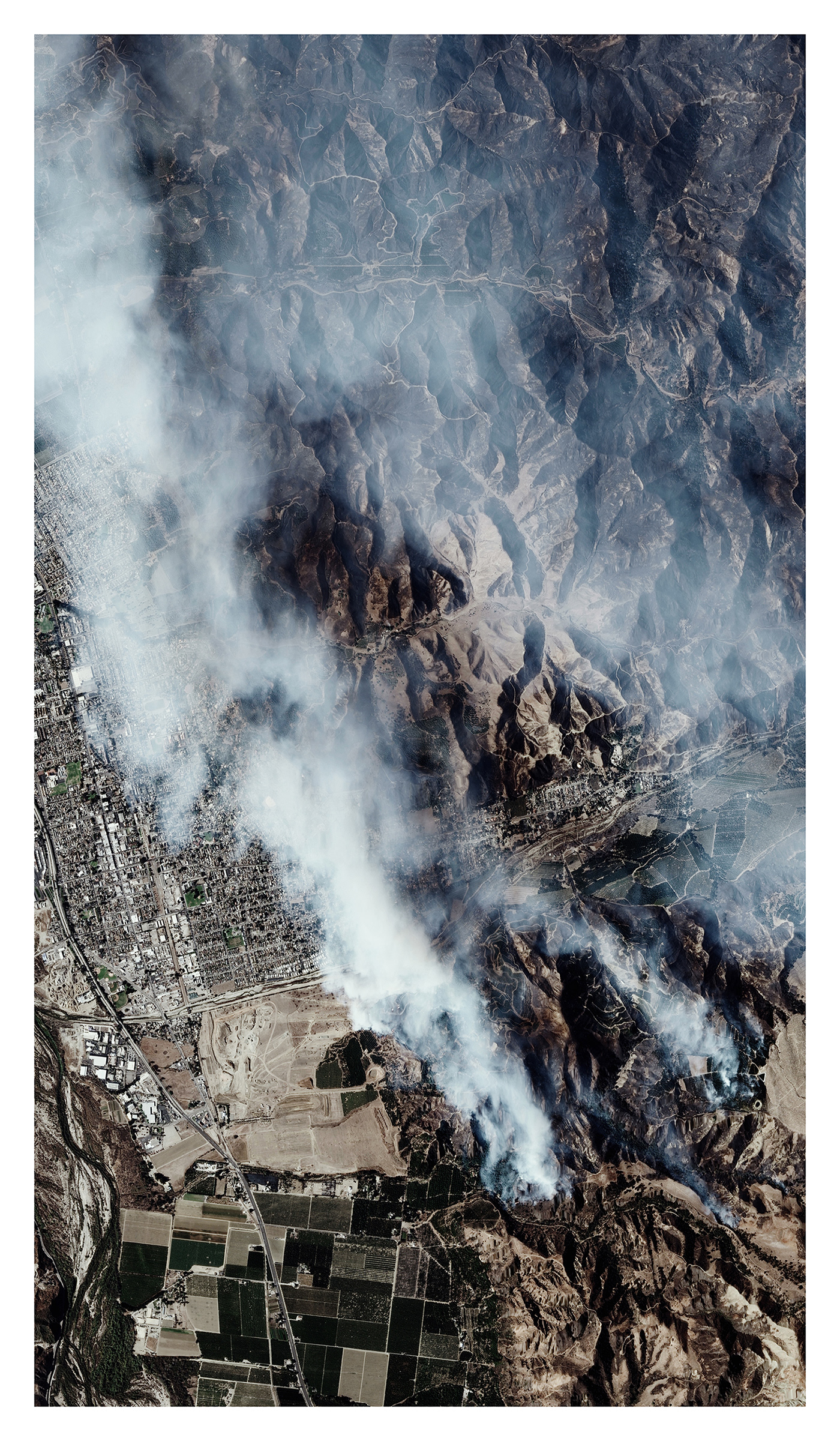
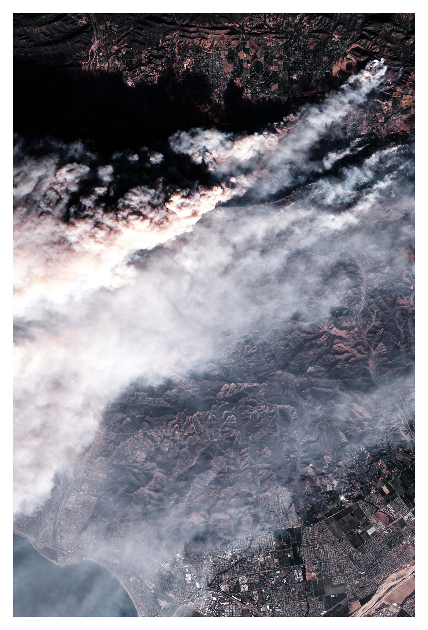
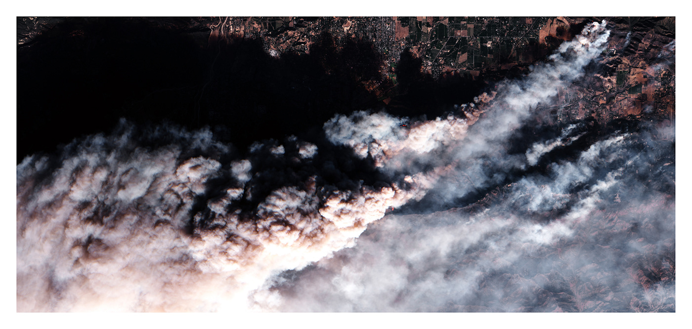
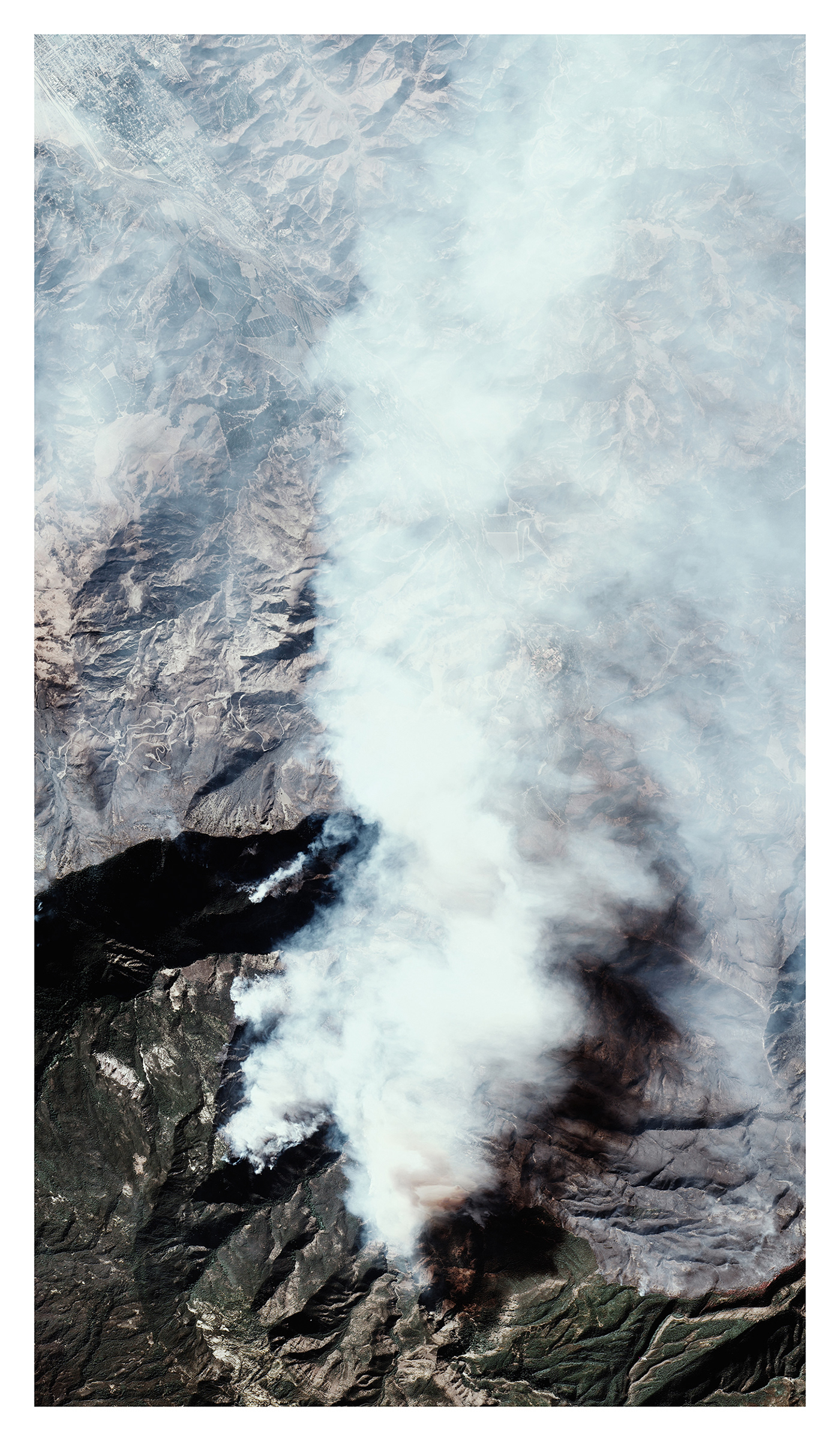
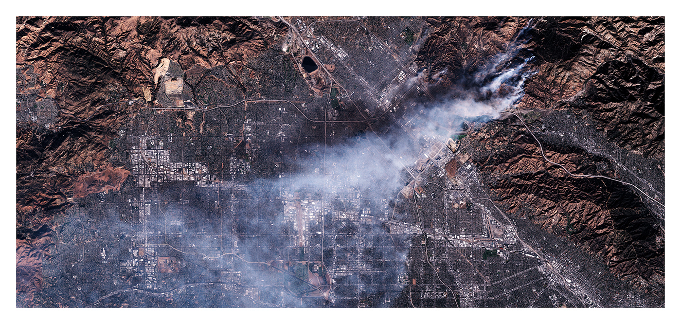
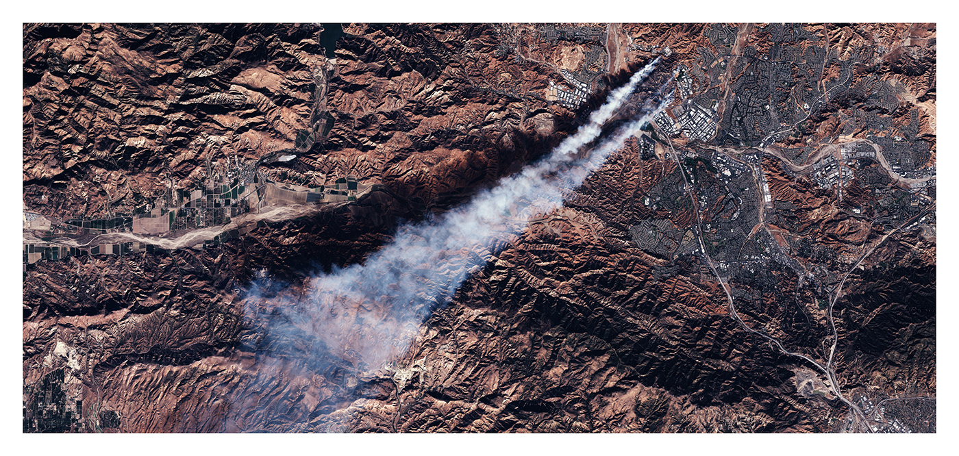
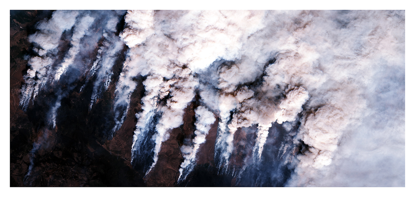
« The idea came into my mind by scrolling randomly through Google Earth. While flying over California, I came accross images capturing a forest fire », reveals Tomas Paturet. This graduated architect and creator of online journal « Atlas of Places » offers here a unique series called « A Distinct Fire ». From Oklahoma to California and Siberia, he collected images of the last three largest forest fires of 2018. Taken by the ESA Multispectral Instrument, on the Sentinel-2 satellite. « I assembled them with mapping software and retouched them on Photoshop », he explains.
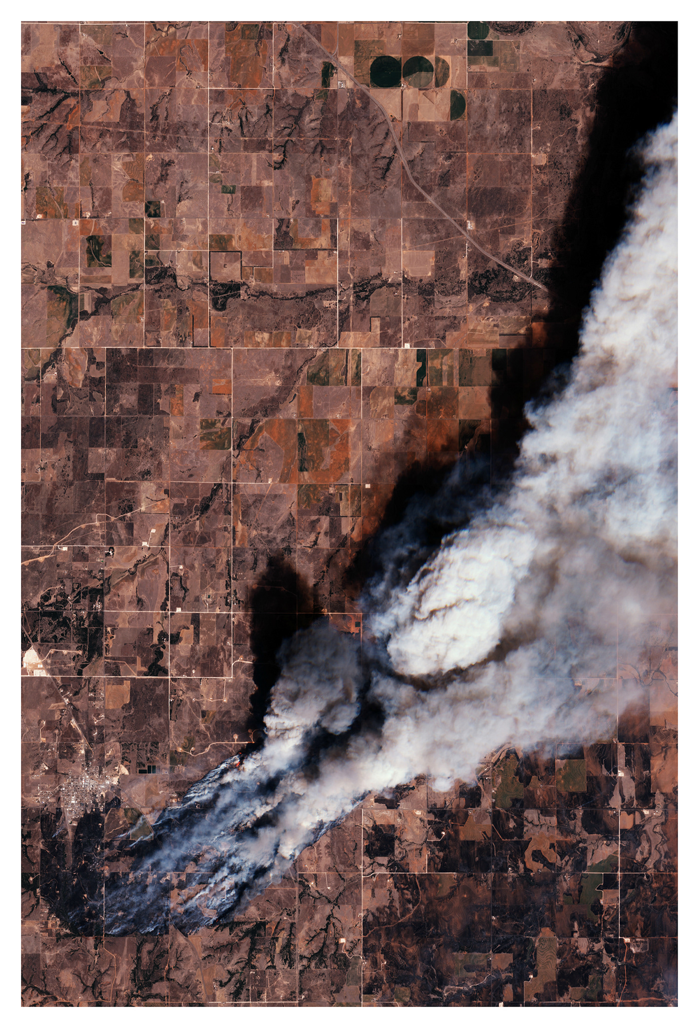
« The devastating beauty of this event, this power of remarkable territorial breadth, made me look for the sources of data and archive other places. It is often difficult to perceive the scale of these social, environmental and economical disasters. These images help to change perspectives. To take a step back on the impact of climate change on our planet ».
Found more about his work on his Instagram page : @atlasofplaces.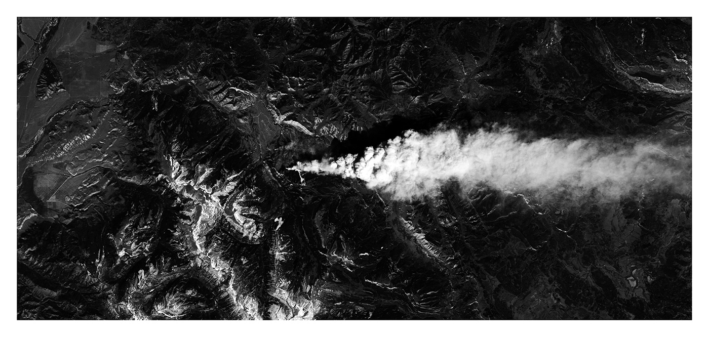
Images Galerie (13)